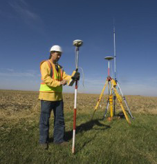
GPS Survey
Access commonly used survey links for the CORS antenna reference stations, Real Time Status Map (RTVRN), Open Data Survey page, the County Surveyor, Federal Lands Records Site, and Survey Deposits database.
Resources
The GPS Survey group
GPS Survey is a part of the Mesa County Public Works Department and provides the following services to Mesa County residents:
- Manages the Mesa County Real-Time Virtual Reference Network (RTVRN).
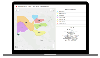
- Creates and maintains the Local Coordinate Systems for Mesa County.
- Responsible for surveying services for Mesa County Public Works and other Departments of Mesa County.
- Answers Questions on Right-of-Way.
Mesa County Real-Time Virtual Reference Network (RTVRN)
The Mesa County RTVRN is a service that provides real-time corrections to GPS/GNSS devices in surveying, construction, agriculture, mapping, and science industries. The Mesa County RTVRN has 33 Continuously Operating Reference Stations (CORS), with partners in local and state government agencies and private businesses. The Mesa County RTVRN covers all of Western Colorado.
To access the Mesa County RTVRN, you must sign up for a subscription; they are free to the public. Please go to rtvrn.mesacounty.us to sign up for an account and to view the coverage map.
Mesa County Local Coordinate Systems (MCLCS) map
GPS Survey
Central Services (GPS Survey Group)
200 S. Spruce StreetGrand Junction, CO 81501